You have found the course web site or you wouldn't be reading this. Be sure to print all parts of the site, particularly the semester echedule. If we make any schedule changes, I will update that file and repost it. All tests will occur as advertised in the schedule.
Also - you must check your SMU email account regularly. I will use the facility in Access to send messages to the whole class. That won't happen often but I need to know that everybody will get such messages.
Constellations are two-dimensional projections of stars at very different distances. If astronomers on the distant planet Fringus, located hundreds of light years from here, look at this region, they will see a different arrangement of the stars.
Modern astronomers define borders around constellations so that everything in the sky is within a constellation boundary. This makes a common system for astronomers all around the planet to use. There are 88 constellations defined in the entire Celestial Sphere. Some of them are really good and look like their names, like Orion, Scorpius, Ursa Major, Gemini, Leo and others. On the other hand, there are a lot which look like nothing in particular, least of all what they are named for.
Most (not all) of the constellation names are ancient and are tied to Greek and Roman mythology. The constellations that are very far south have more modern names for the simple reason that the residents of ancient Greece and Rome couldn't see them. Seven northern hemisphere constellations were introduced in the 17th century by Polish astronomer Johannes Hevelius in his famous star catalog. Those 7 constellations are Canes Venatici, Lacerta, Leo Minor, Lynx, Scutum, Sextans and Vulpecula. These constellations are all small, dim and inconspicuous. You really have to know where they are to find them.
Because the distances are so large, they appear to be the same. This makes it look like the Earth is on the center of a great sky sphere. All the stars seem to be infinitely far away. We can't fault the ancients for seeing the sky as a hollow sphere; it certainly looks that way.
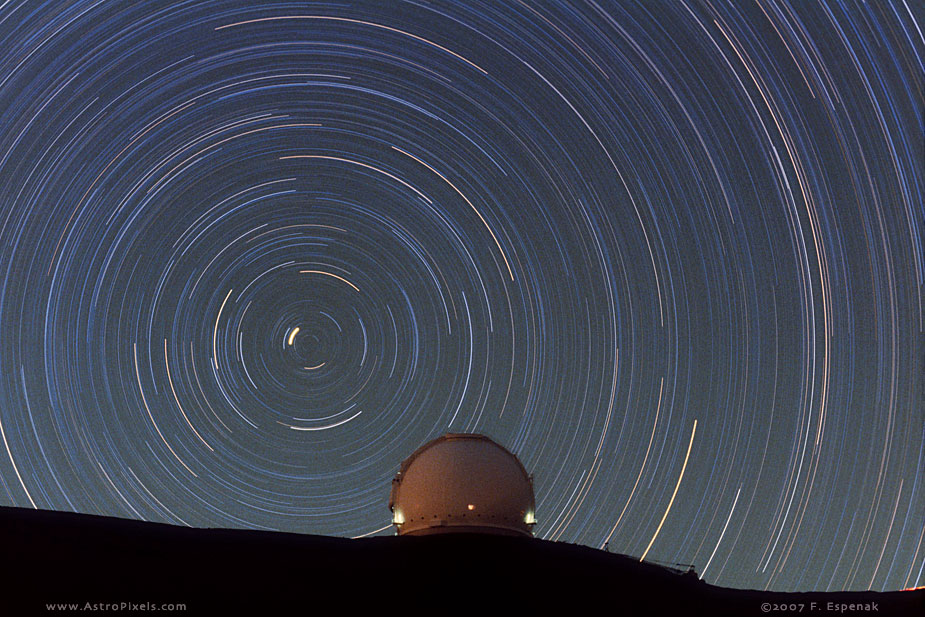
If you watch the sky at night, you will observe stars rising in the East, moving across the sky and reaching maximum altitude above the horizon in the South, then setting in the West. There is a star that does not move - the North Star Polaris. It sits still because it is almost on the Earth's axis. If you set up a camera and take a LOOOONG exposure of the north polar area, you will get a lovely picture of the stars rotating around the North Celestial Pole. It was made on Mauna Kea (Hawaii) near the Keck Observatory. This exposure is approximately 3.3 hours long! The short bright arc near the center of rotation is Polaris, the North Star.
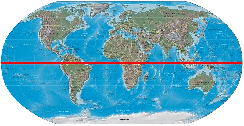
The Earth determines where the Celestial Poles and Celestial Equator are located. If you extend the Earth's axis into space, the points where it intersects the Celestial Sphere are the Celestial Poles. There's a North pole and a South pole. What is an equator? It is a plane which cuts the planet in two exactly through the center (halfway between the poles) and perpendicular to the axis. The Earth's Equator clearly does this.
Earth coordinates are latitude and longitude. Latitude measures angle north or south of the Equator (Equator is 0 degrees) and longitude measures east or west from the zero (prime) meridian. These coordinates are based on Earth's axis. That Prime Meridian is defined by a transit telescope at the old Royal Obvservatory in Greenwich, England (eastern suburb of London). The Prime Meridian could actually be located anywhere; it's in London by international agreement.
Celestial (sky) coordinates are also based on Earth's axis. The geocentric sky coordinates have names different from latitude to avoid confusion with other coordinate systems. There is a coordinate system centered on the Sun (heliocentric coordinates) which uses latitude and longitude.
In the sky the latitude equivalent is called Declination and it works exactly like latitude does. As a convention, north declinations are shown as + and south declinations are shown as -. In place of longitude we have Right Ascension. It differs slightly from Earth longitude in that it always measures eastward from the zero point. The sky coordinates are used just like Earth coordinates, but you won't see them drawn on the sky. You'll have to use a map.
Zero of declination is the Celestial Equator; zero for Right Ascension is the vernal equinox point.